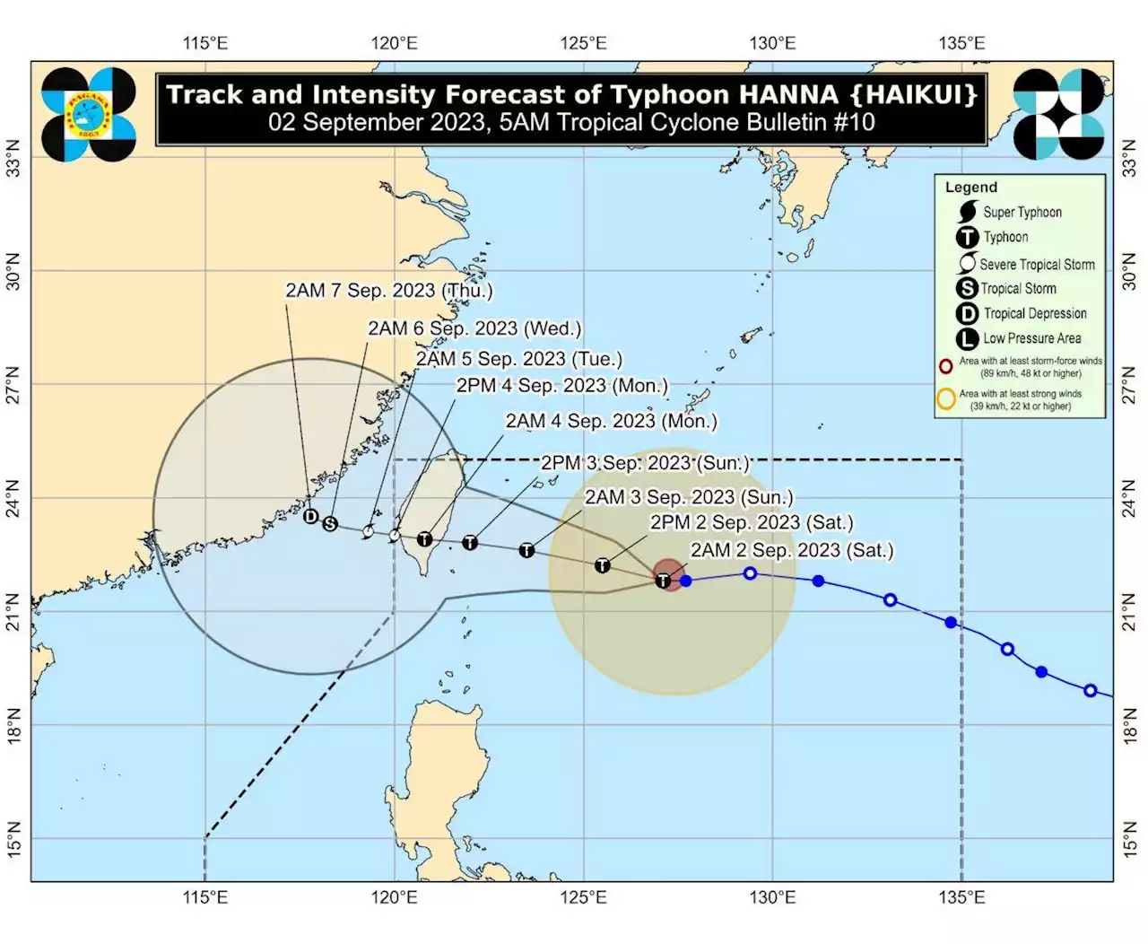
As of early Saturday, September 2, Typhoon Hanna (Haikui) is located 520 kilometers east northeast of Itbayat, Batanes
MANILA, Philippines – Typhoon Hanna is still not expected to make landfall in the Philippines, but its track has shifted southward so it is now seen to affect Batanes.at 5 am on Saturday, September 2. This gives the province lead time of 36 hours to prepare for strong winds from Hanna.
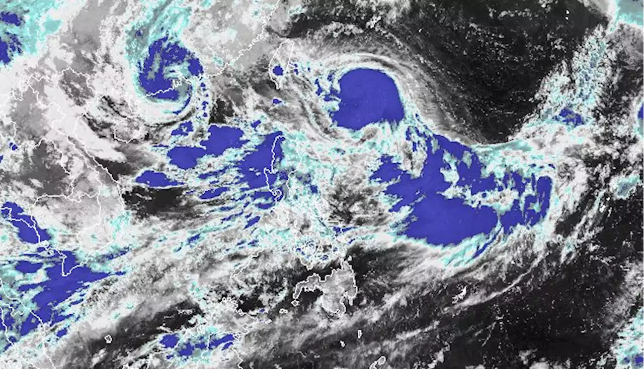
The typhoon continues to have maximum sustained winds of 120 km/h and gustiness of up to 150 km/h. It could gradually intensify during the weekend. Hanna could eventually just be a tropical depression by late Wednesday, September 6, or early Thursday, September 7.And, along with Hanna, two tropical cyclones outside PAR have been enhancing the southwest monsoon – Typhoon Goring and Kirogi, which has weakened from a severe tropical storm into a tropical storm.
Indonesia Berita Terbaru, Indonesia Berita utama
Similar News:Anda juga dapat membaca berita serupa dengan ini yang kami kumpulkan dari sumber berita lain.
 Southward shift by Hanna may cause Signal No. 1 in BatanesTyphoon Hanna has maintained its strength as it continued to move 15 kph westward over the Philippine Sea. According to the tropical cyclone bulletin released at past 11 p.m. on Friday, the eye of the storm was last seen 595 kilometers east northeast of Basco, Batanes. It has with maximum sustained winds of 120 kph and gustiness of up to 150 kph. For the rest of the forecast period, Hanna is anticipated to move generally westward or west northwestward, but a possible southward shift in the forecast may cause the hoisting of tropical cyclone wind Signal No. 1 over Batanes. Hanna is expected to exit the Philippine Area of Responsibility and emerge over the Taiwan Strait between Sunday evening to Monday morning as a severe tropical storm or a minimal typhoon. No tropical cyclone wind signals have been raised, but the typhoon continues to enhance the Southwest Monsoon along with Typhoon Soila and Severe Tropical Storm Kirogi just outside the Philippine Area of Responsibility. As a result of the enhanced Southwest Monsoon, occasional to monsoon rains over the western portion of Luzon is to be expected within the next three days. Gusty conditions have also been forecast in the following areas: Friday to Sunday: Batanes, Babuyan Islands, Ilocos Region, Cordillera Administrative Region, Nueva Vizcaya, Zambales, Pampanga, Bataan, Aurora, Bulacan, Metro Manila, CALABARZON, MIMAROPA, Bicol Region, Western Visayas, and the northern portion of Eastern Visayas. Monday: Batanes, Babuyan Islands, Ilocos Region, Cordillera Administrative Region, Nueva Vizcaya, Zambales, Pampanga, Bataan, Aurora, Bulacan, Metro Manila, CALABARZON, and most of Bicol Region, MIMAROPA, and Western Visayas. A gale warning is also in effect for most seaboards of Luzon and Western Visayas, and the seaboard of Northern Samar due to the enhanced Southwest Monsoon.
Baca lebih lajut »
 Batanes under Signal No. 1 due to Hanna; Habagat to bring rains over western LuzonTropical Cyclone Wind Signal No. 1 was raised over Batanes early Saturday as Typhoon Hanna (international name: Haikui) continues moving generally westward towards the sea east of Taiwan, PAGASA said in its bulletin.
Baca lebih lajut »
 Hanna continues to intensify; Batanes under Signal No. 1Typhoon Hanna continued to intensify while moving west-northwestward towards the sea east of Taiwan, the state weather bureau PAGASA said Saturday afternoon.
Baca lebih lajut »
 FACT CHECK: Hindi super typhoon ang bagyong Hanna, walang Signal No. 5Sa kasalukuyan, walang wind signal warning na nakataas sa alinmang bahagi ng bansa dahil sa Bagyong Hanna
Baca lebih lajut »
 Batanes still assessing Goring damage even as it already feels Hanna's effectsThe province of Batanes has yet to fully assess the damage caused by Typhoon Goring but it is already feeling the effects of Typhoon Hanna (international name: Haikui) on Saturday.
Baca lebih lajut »
 Hanna to be a typhoon on Friday, seen to enhance Southwest MonsoonSevere Tropical Storm Hanna continued to move 20 kph on its west northwestward path over the Philippine Sea, according to PAGASA’s 11:00 PM cyclone bulletin on Thursday.
Baca lebih lajut »