
The low pressure area (LPA) being monitored by the Philippine Atmospheric, Geophysical and Astronomical Services Administration (PAGASA) has developed into a tropical depression and was given a local name “Chedeng.” ManilaBulletin READ:
Although a landfall is less likely, PAGASA said Chedeng could strengthen the southwest monsoon or "habagat," which could bring rains to parts of the country in the coming days.
The LPA became a tropical depression around 8 a.m., Tuesday, June 6, and was last spotted 1,170 kilometers east of Central Luzon around 11 a.m.“Tropical depression Chedeng is forecast to remain far from the Philippine landmass. As such, it is unlikely to directly bring heavy rainfall over any portion of the country in the next three to five days,” PAGASA said.
As of Tuesday, Chedeng was packing maximum sustained winds of 45 kilometers per hour near the center and gusts as high as 55 kph, while almost stationary over the Philippine Sea.
Indonesia Berita Terbaru, Indonesia Berita utama
Similar News:Anda juga dapat membaca berita serupa dengan ini yang kami kumpulkan dari sumber berita lain.
 TD Chedeng may reach typhoon category by Thursday —PAGASATropical Depression Chedeng is expected to become a typhoon in the coming days and become stronger by the weekend, according to PAGASA. “This tropical cyclone may reach typhoon category by Thursday and reach its peak intensity during the weekend while over the Philippine Sea east of Northern Luzon,” the state weather bureau said in its 11 a.m. advisory on Tuesday.
Baca lebih lajut »
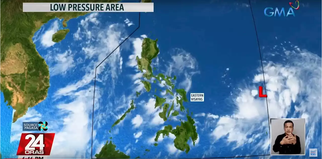
 PAGASA monitoring LPA, cloud cluster which could intensify outside PARPAGASA is monitoring a low pressure area west of Luzon with a low chance of entering the Philippine Area of Responsibility, and a cloud cluster east of Visayas and Mindanao which could become an LPA and enter the PAR early next week.
Baca lebih lajut »
 Pagasa: Potential LPA may enter PAR MondayThe state weather bureau is monitoring two weather systems, one of which is a possible low pressure area that may enter the Philippine area of responsibility by Monday or Tuesday. | JMangaluzINQ
Baca lebih lajut »
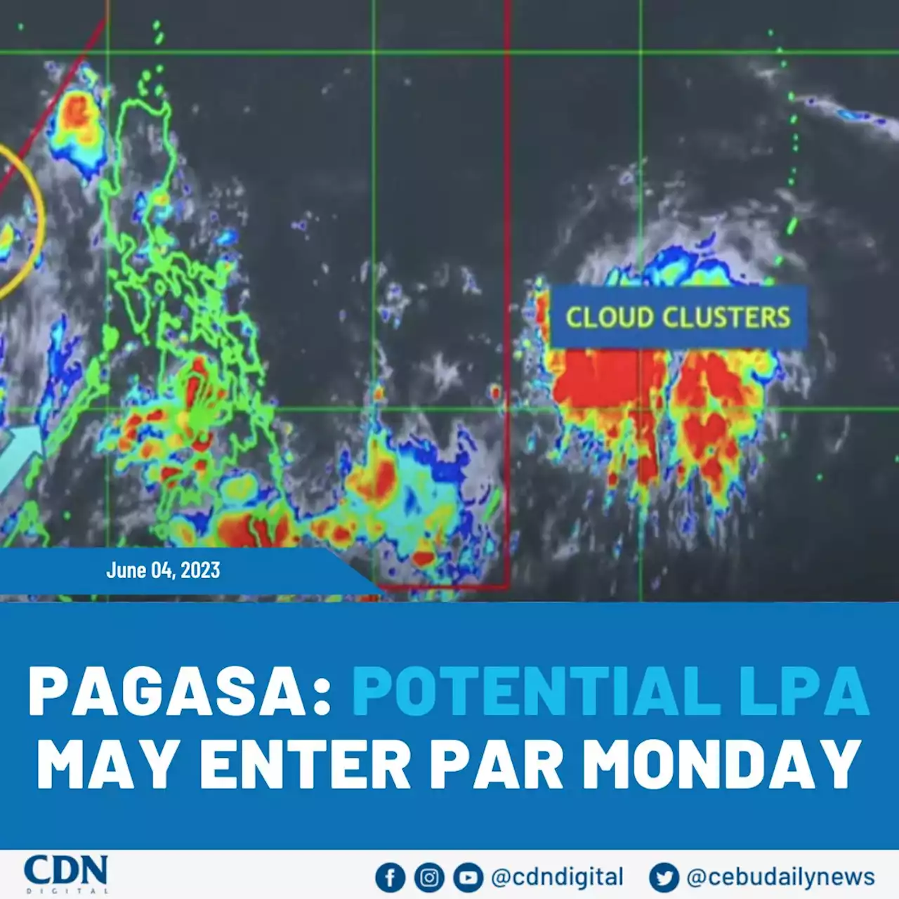 Pagasa: Potential LPA may enter PAR MondayThe state weather bureau is monitoring two weather systems, one of which is a possible low pressure area that may enter the Philippine area of responsibility by Monday or Tuesday. CDNDigital READ:
Baca lebih lajut »
 Pagasa: LPA enters PAR; may become tropical cyclone within 24-48 hoursMANILA, Philippines — The low pressure area (LPA) off Eastern Visayas entered the Philippine area of responsibility on Monday afternoon, state meteorologists said. Aldczar Aurelio, weather
Baca lebih lajut »
 PAGASA: LPA inside PAR may develop into stormA low-pressure area (LPA) inside the Philippine Area of Responsibility (PAR) may develop into a storm, the state weather bureau PAGASA said Monday in a ”24 Oras” report.
Baca lebih lajut »