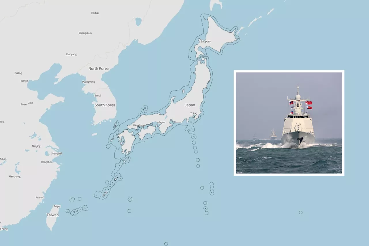
The Japanese Defense Ministry has released more than 100 reports of suspicious ship movements in the past 12 months.
U.S. security treaty ally Japan recorded intensive maneuvers by the Russian and Chinese navies in its surrounding waters in the past year, with both neighbors frequently transiting near its territory as their ships sailed in and out of the expansive waters of the Pacific Ocean, government data shows.
Visible in the graphic, shown in red circles, are the Chinese aircraft carrier Shandong's deployments to the Philippine Sea last April, September, October and November, when Japanese crews photographed the flat-top—China's first domestically built carrier and its second overall—as helicopters and fighter jets took off from and landed on its deck with destroyers serving as escorts.
Indonesia Berita Terbaru, Indonesia Berita utama
Similar News:Anda juga dapat membaca berita serupa dengan ini yang kami kumpulkan dari sumber berita lain.
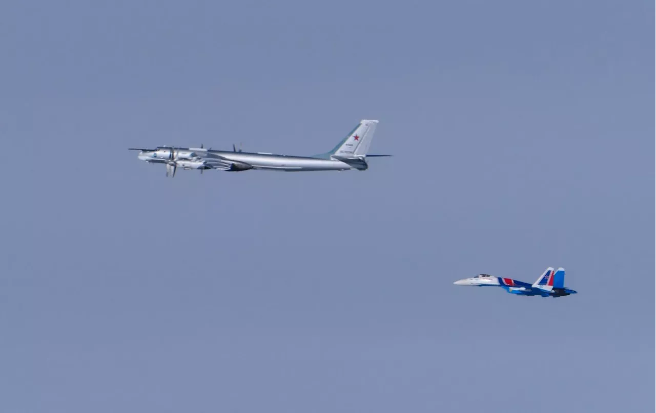 Map Shows Where Japan Intercepted Russian and Chinese AircraftJapan shares maritime borders—and territorial disputes—with potential adversaries Russia, China and North Korea.
Baca lebih lajut »
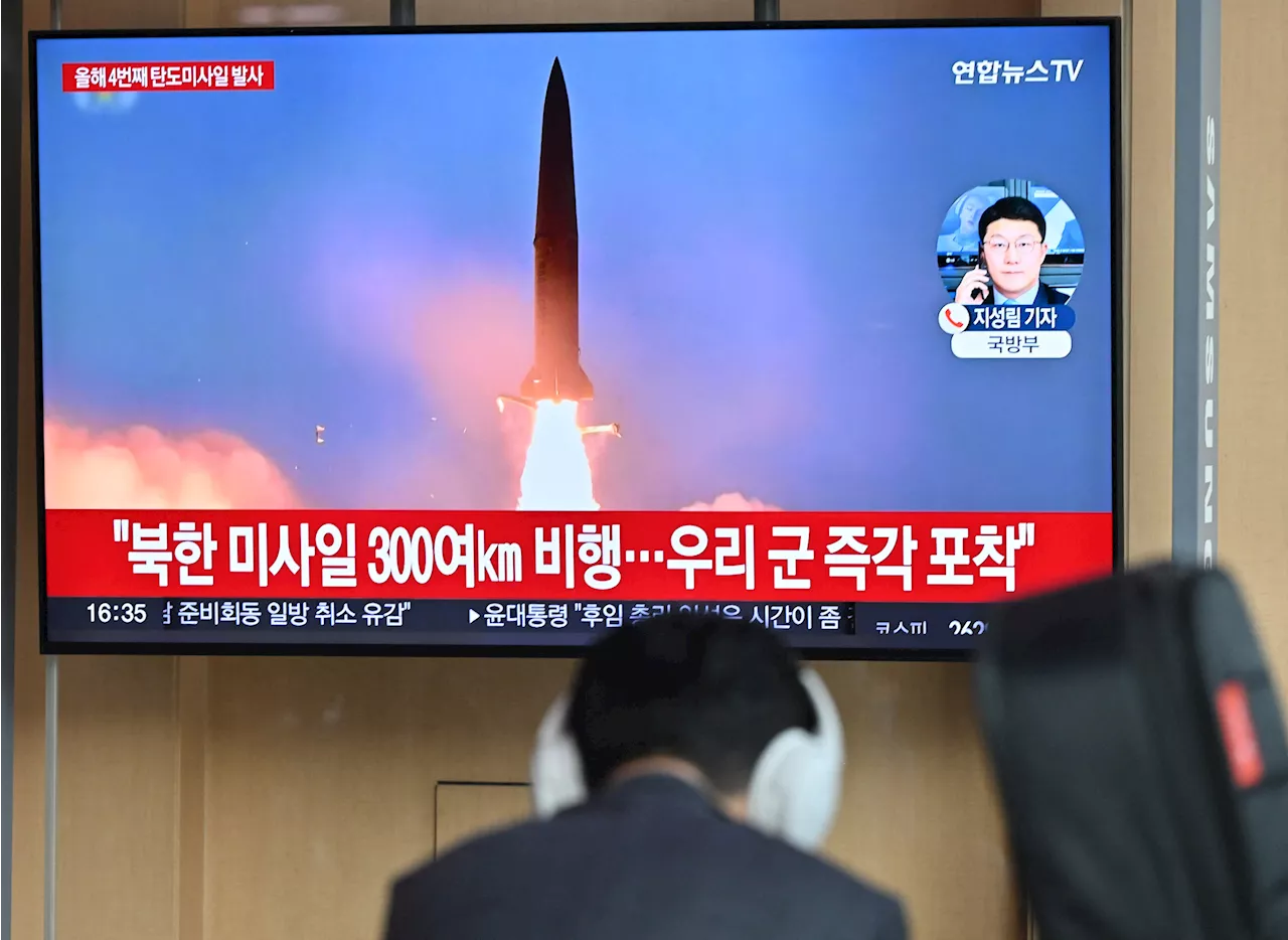 North Korea Fires Ballistic Missiles Into Sea of Japan—MapInter-Korean relations are at a low point not seen in decades, fuelled by the North's weapons tests and war talk.
Baca lebih lajut »
 Map Shows States Where Boycotting Israel is IllegalIn recent weeks, pro-Palestinian protests have been staged at colleges like Columbia University and Northwestern University.
Baca lebih lajut »
 Map Shows Where Internet Service Fees Are Due to RiseMillions of Americans could lose subsidized internet access after Congress failed to approve additional funding for the ACP.
Baca lebih lajut »
 College Tuition Map Shows Rising Fees in 5 StatesUniversity fees have increased by more than 28 percent over eight years in one U.S. state
Baca lebih lajut »
 California Map Shows Power Outage Warning as Special Storm Alert IssuedThe winds will be the worst on Friday afternoon and evening.
Baca lebih lajut »