
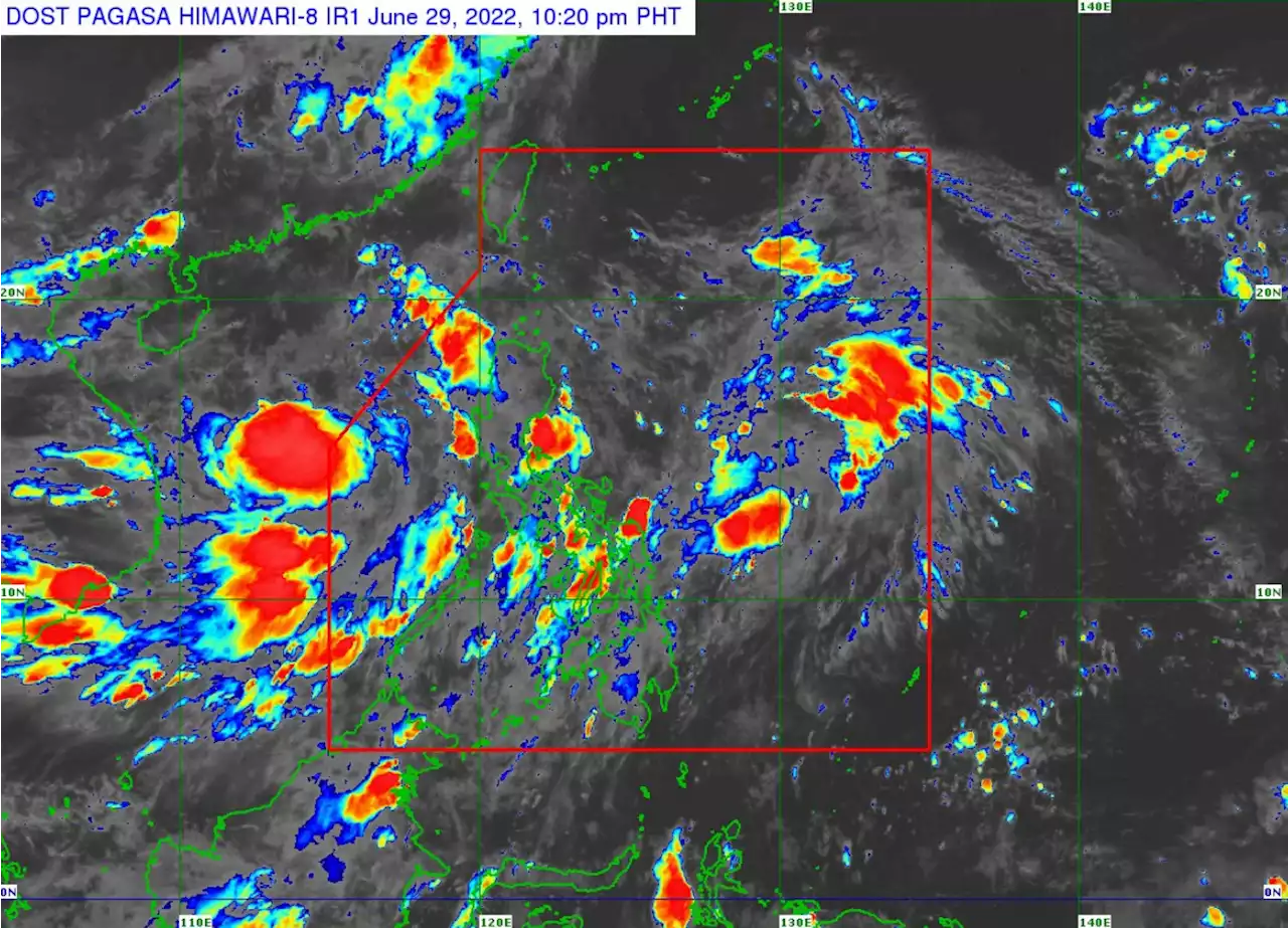
Tropical depression Caloy has exited the Philippine area of responsibility (PAR), the state weather bureau said on Thursday, June 30. READ:
Tropical depression Caloy has exited the Philippine area of responsibility , the state weather bureau said on Thursday, June 30.
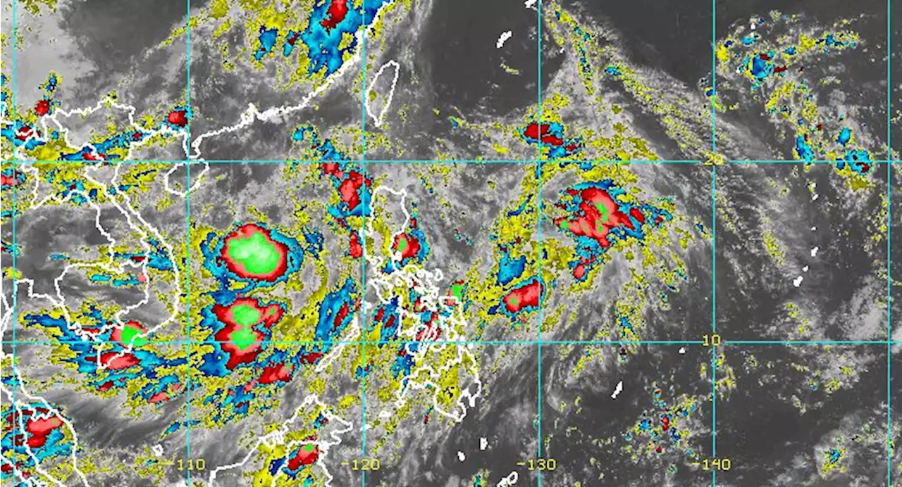
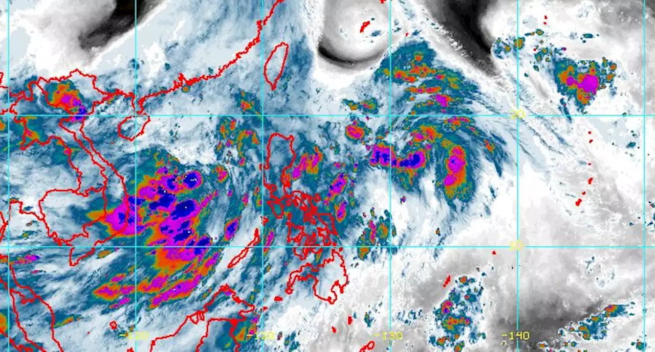
Caloy was last spotted 575 kilometers west of Iba, Zambales. It has maximum sustained winds of 55 kilometers per hour near the center, gustiness of up to 70 kph, and it is moving westward slowly. “After nitong si Caloy ay meron tayong binabantayan na weather disturbance sa silangan ng Luzon ,” said Estareja in a public weather forecast.
The monsoon rains may affect Bataan, Zambales, Oriental Mindoro, Occidental Mindoro, Aurora, and Quezon. Residents of the said areas were advised to remain vigilant against flash floods or landslides during moderate to at times heavy rains.
Indonesia Berita Terbaru, Indonesia Berita utama
Similar News:Anda juga dapat membaca berita serupa dengan ini yang kami kumpulkan dari sumber berita lain.
 Tropical Depression Caloy slightly strengthens; new LPA forms inside PARWeatherAlert: Tropical Depression Caloy continues to enhance the southwest monsoon, the source of the rain in parts of Luzon and Western Visayas. CaloyPH PAGASA is also monitoring a new low pressure area.
Baca lebih lajut »
 LPA west of Zambales now tropical depression CaloyThe low pressure area (LPA) west of Zambales on Tuesday developed into a tropical depression which has been named Caloy, the weather bureau PAGASA has said.
Baca lebih lajut »
 LPA develops into Tropical Depression Caloy, enhances southwest monsoonWeatherAlert: Tropical Depression Caloy is expected to be out of the Philippine Area of Responsibility by Wednesday, June 29. But there will be rain from the southwest monsoon, which is being enhanced by Caloy. CaloyPH
Baca lebih lajut »
 PAGASA: Caloy slightly intensifies while moving slowly over West Philippine SeaIn its 11 p.m. bulletin, PAGASA said the tropical depression may develop into a tropical storm category in the next 24 hours. It is expected to move generally northwestward slowly until Thursday morning before slightly accelerating northward for the rest of the day.
Baca lebih lajut »
 Tropical Depression Caloy exits PAR but continues to enhance southwest monsoonWeatherAlert: Tropical Depression Caloy is already outside the Philippine Area of Responsibility. But the enhanced southwest monsoon will still affect parts of Luzon and Western Visayas on Thursday, June 30. CaloyPH
Baca lebih lajut »
 Caloy maintains strength, now outside PARTropical Depression Caloy is now outside the Philippines as Bataan, Zambales, Palawan, Oriental Mindoro, Occidental Mindoro, Aurora and Quezon will exprience monsoon rains due to the monsoon trough / southwest monsoon, PAGASA reported.
Baca lebih lajut »